ARMENIA

Geography: Armenia is located in the southern Caucasus and is the smallest of the former Soviet republics. It is bounded by Georgia on the north, Azerbaijan on the east, Iran on the south, and Turkey on the west. Contemporary Armenia is a fraction of the size of ancient Armenia. A land of rugged mountains and extinct volcanoes, its highest point is Mount Aragats, 13,435 ft (4,095 m).
Government: Republic.
History: One of the world's oldest civilizations, Armenia once included Mount Ararat, which biblical tradition identifies as the mountain that Noah's ark rested on after the flood. It was the first country in the world to officially embrace Christianity as its religion (c. A.D. 300).
In the 6th century B.C. , Armenians settled in the kingdom of Urartu (the Assyrian name for Ararat), which was in decline. Under Tigrane the Great (fl. 95–55 B.C. ) the Armenian empire reached its height and became one of the most powerful in Asia, stretching from the Caspian to the Mediterranean seas. Throughout most of its long history, however, Armenia has been invaded by a succession of empires. Under constant threat of domination by foreign forces, Armenians became both cosmopolitan as well as fierce protectors of their culture and tradition.
Over the centuries Armenia was conquered by Greeks, Romans, Persians, Byzantines, Mongols, Arabs, Ottoman Turks, and Russians. From the 16th century through World War I, major portions of Armenia were controlled by their most brutal invader, the Ottoman Turks, under whom the Armenians experienced discrimination, religious persecution, heavy taxation, and armed attacks. In response to Armenian nationalist stirrings, the Turks massacred thousands of Armenians in 1894 and 1896. The most horrific massacre took place in April 1915 during World War I, when the Turks ordered the deportation of the Armenian population to the deserts of Syria and Mesopotamia. According to the majority of historians, between 600,000 and 1.5 million Armenians were murdered or died of starvation. The Armenian massacre is considered the first genocide of the 20th century. Turkey denies that a genocide took place and claims that a much smaller number died in a civil war.
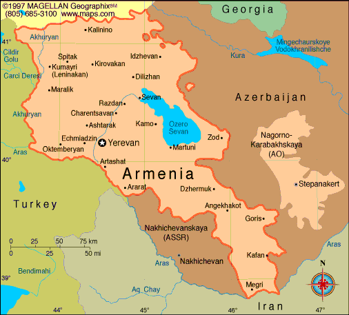
Map of Armenia
President:
Serzh Sarkisyan (2008)
Prime
Minister: Hovik Abrahamyan (2014)
Land
area: 11,506 sq mi (29,800 sq km); total area: 11,506 sq mi
(29,800 sq km)
Population (2014 est.):
3,060,631 (growth rate: -0.13%); birth rate: 13.92/1000; infant
mortality rate: 13.97/1000; life expectancy: 74.12
Capital and largest city (2011 est.):
Yerevan, 1.116
Other large cities:
Vanadzor, 147,400; Gyumri (Leninakan), 125,300; Abovian, 59,300
Monetary unit: Dram
National Name: Hayastani
Hanrapetut'yun
Languages:
Armenian (official) 97.9%, Kurdish (spoken by Yezidi minority) 1%, other 1% (2011 est.)
Ethnicity/race:
Armenian 98.1%, Yezidi (Kurd) 1.1%, other 0.7% (2011 est.)
Religion:
Armenian Apostolic 92.6%, Evangelical 1%, other 2.4%, none 1.1%, unspecified 2.9% (2011 est.)
National Holiday:
Independence Day, September 21
Literacy rate: 99.4% (2012 est.)
Economic summary: GDP/PPP (2013 est.):
$20.61 billion; per capita $6,300. Real growth rate: 4.6%.
Inflation: 6.2%. Unemployment:17.3% (2013 est.).
Arable land: 14.47%. Agriculture: fruit (especially
grapes), vegetables; livestock. Labor force: 1.394 million;
agriculture 44.2%, industry 16.8%, services 39% (2008 est).
Industries: diamond processing, metal-cutting machine tools,
forging-pressing machines, electric motors, tires, knitted wear,
hosiery, shoes, silk fabric, chemicals, trucks, instruments,
microelectronics, jewelry manufacturing, software development, food
processing, brandy. Natural resources: small deposits of gold,
copper, molybdenum, zinc, alumina. Exports: $1.653 billion (2013): diamonds, mineral products, foodstuffs, energy.
Imports: $3.459 billion (2013 est.): natural gas,
petroleum, tobacco products, foodstuffs, diamonds. Major trading
partners: Russia, Belgium, Germany,
Iran, U.S., Georgia, Netherlands, Canada, Bulgaria, Switzerland(2012)
Communications: Telephones: main lines in
use: 584,000 (2012); mobile cellular: 3.223 (2012). Broadcast media:
2 public TV networks operating alongside more than 40 privately owned
TV stations that provide local to near nationwide coverage; major
Russian broadcast stations are widely available; subscription cable TV
services are available in most regions; Public Radio of Armenia is a
national, state-run broadcast network that operates alongside about 20
privately owned radio stations; several major international broadcasters
are available (2008).
Internet hosts: 194,142 (2012). Internet users: 208,200
(2011).
Transportation: Railways:
total: 869 km (2012). Highways: total: 7,705 km (2012). Waterways: n.a.
Ports and harbors: none. Airports: 11 (2013).
International disputes: the
dispute over the break-away Nagorno-Karabakh region and the Armenian
military occupation of surrounding lands in Azerbaijan remains the
primary focus of regional instability; residents have evacuated the
former Soviet-era small ethnic enclaves in Armenia and Azerbaijan;
Turkish authorities have complained that blasting from quarries in
Armenia might be damaging the medieval ruins of Ani, on the other side
of the Arpacay valley; in 2009, Swiss mediators facilitated an accord
reestablishing diplomatic ties between Armenia and Turkey, but neither
side has ratified the agreement and the rapprochement effort has
faltered; local border forces struggle to control the illegal transit of
goods and people across the porous, undemarcated Armenian, Azerbaijani,
and Georgian borders; ethnic Armenian groups in the Javakheti region of
Georgia seek greater autonomy from the Georgian Government.
-------------------- o --------------------
No comments:
Post a Comment