COSTA RICA
Geography: This Central American country lies between Nicaragua to the north and Panama to the south. Its area slightly exceeds that of Vermont and New Hampshire combined. It has a narrow Pacific coastal region. Cocos Island (10 sq mi; 26 sq km), about 300 mi (483 km) off the Pacific Coast, is under Costa Rican sovereignty.
Government: Democratic republic.
History: Costa Rica was inhabited by an estimated 400,000 Indians when Columbus explored it in 1502. The Spanish conquest began in 1524. The region grew slowly and was administered as a Spanish province. Costa Rica achieved independence in 1821 but was absorbed for two years by Agustín de Iturbide in his Mexican empire. It became a republic in 1848. Except for the military dictatorship of Tomás Guardia from 1870 to 1882, Costa Rica has enjoyed one of the most democratic governments in Latin America.
In the 1970s, rising oil prices, falling international commodity prices, and inflation hurt the economy. Efforts have since been made to reduce reliance on coffee, banana, and beef exports. Tourism is now a major business. Óscar Arias Sánchez worked to simultaneously heal his country's economic woes and foster peace in Central America.
José Maria Figueres Olsen of the National Liberation Party became president in 1994. He opposed economic suggestions made by the International Monetary Fund, instead favoring greater government intervention in the economy. The World Bank subsequently withheld $100 million of financing. In 1998, Miguel Angel Rodríguez of the Social Christian Unity Party became president, pledging economic reforms, such as privatization. In 2000, Costa Rica and Nicaragua resolved a long-standing dispute over navigation of the San Juan River, which forms their shared border. A psychiatrist, Abel Pacheco, also of the Social Christian Unity Party, won the presidency in elections held in April 2002. In May 2003, several national strikes took place, by energy and telecommunications workers over privatization and by teachers over their salaries.
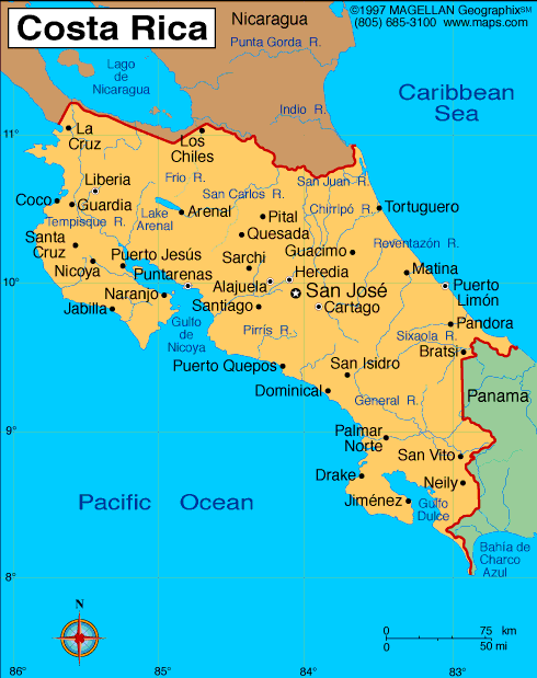
Map of Costa
Rica
Land area: 19,560 sq mi (50,660 sq km);
total area: 19,730 sq mi (51,100 sq km)
Population (2014 est.): 4,755,234
(growth rate: 1.24%); birth rate: 16.08/1000; infant mortality rate:
8.7/1000; life expectancy: 78.23
Capital and largest city (2011 est.):
San José, 1.515 million
Monetary unit: Colón
National name: República de
Costa Rica
Languages:
Spanish (official), English
Ethnicity/race:
white or mestizo 83.6%, mulato 6.7%, indigenous 2.4%,
black of African descent 1.1%, other 1.1%, none 2.9%, unspecified 2.2%
(2011 est.)
National Holiday:
Independence Day, September 15
Religion:
Roman Catholic 76.3%, Evangelical 13.7%, Jehovah's Witnesses 1.3%, other Protestant 0.7%, other 4.8%, none 3.2%
Literacy rate: 96.3% (2011 est.)
Economic summary: GDP/PPP (2013
est.): $61.43 billion; per capita $12,900. Real growth rate:
3.5%. Inflation: 5.6%. Unemployment: 7.9%.
Arable land: 4.89%. Agriculture: coffee, pineapples,
bananas, sugar, corn, rice, beans, potatoes; beef; timber. Labor
force: 2.222 million; agriculture 14%, industry 22%, services 64%
(2006 est.). Industries: microprocessors, food processing,
textiles and clothing, construction materials, fertilizer, plastic
products. Natural resource: hydropower. Exports:
$11.66 billion (2013 est.): coffee, bananas, sugar, pineapples;
textiles, electronic components, medical equipment. Imports:
$17.56 billion (2013 est.): raw materials, consumer goods, capital
equipment, petroleum. Major trading partners: U.S.,
Netherlands, Hong Kong, Nicaragua, Mexico, China (2012).
Communications: Telephones: main lines
in use: 1.018 million (2012); mobile cellular: 6.151 million (2012).
Broadcast media: multiple privately owned TV
stations and 1 publicly owned TV station; cable network services are
widely available; more than 100 privately owned radio stations and a
public radio network (2007).
Internet hosts: 147,258 (2012). Internet users: 1.485 million
(2009).
Transportation: Railways: total: 278 km
(2008). Roadways: total: 38,049 km; (2010). Waterways: 730 km (seasonally navigable by
small craft) (2004). Ports and harbors: Caldera, Puerto
Limon. Airports: 161 (2013 est.).
International disputes:
Costa Rica and Nicaragua regularly file border dispute cases over the
delimitations of the San Juan River and the northern tip of Calero
Island to the International Court of Justice (ICJ); in 2009, the ICJ
ruled that Costa Rican vessels carrying out police activities could not
use the river, but official Costa Rican vessels providing essential
services to riverside inhabitants and Costa Rican tourists could travel
freely on the river; in 2011, the ICJ provisionally ruled that both
countries must remove personnel from the disputed area; in 2013, the ICJ
rejected Nicaragua's 2012 suit to halt Costa Rica's construction of a
highway paralleling the river on the grounds of irreparable
environmental damage; in 2013, the ICJ, regarding the disputed
territory, ordered that Nicaragua should refrain from dredging or canal
construction and refill and repair damage caused by trenches connecting
the river to the Caribbean and upheld its 2010 ruling that Nicaragua
must remove all personnel; in early 2014, Costa Rica brought Nicaragua
to the ICJ over offshore oil concessions in the disputed region.
-------------------- o --------------------
No comments:
Post a Comment