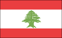
LEBANON

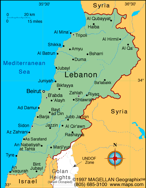
Geography: Lebanon lies at the eastern end of the Mediterranean Sea, north of Israel and west of Syria. It is four-fifths the size of Connecticut. The Lebanon Mountains, which run parallel to the western coast, cover most of the country, while on the eastern border is the Anti-Lebanon range. Between the two lies the Bekaa Valley, the principal agricultural area.
Government: Republic.
History: After World War I, France was given a League of Nations mandate over Lebanon and its neighbor Syria, which together had previously been a single political unit in the Ottoman Empire. France divided them in 1920 into separate colonial administrations, drawing a border that separated mostly Muslim Syria from the kaleidoscope of religious communities in Lebanon, where Maronite Christians were then dominant. After 20 years of the French mandate regime, Lebanon's independence was proclaimed on Nov. 26, 1941, but full independence came in stages. Under an agreement between representatives of Lebanon and the French National Committee of Liberation, most of the powers exercised by France were transferred to the Lebanese government on Jan. 1, 1944. The evacuation of French troops was completed in 1946.
According to the unwritten National Pact, different religious communities were represented in the government by a Maronite Christian president, a Sunni Muslim prime minister, and a Shiite national assembly speaker. This arrangement worked for two decades.
Civil war broke out in 1958, with Muslim factions led by Kamal Jumblat and Saeb Salam rising in insurrection against the Lebanese government headed by President Camille Chamoun, a Maronite Christian favoring close ties to the West. At Chamoun's request, President Eisenhower, on July 15, sent U.S. troops to reestablish the government's authority.

Map of Lebanon
President: Tammam Salam (acting) (2014)
Prime Minister: Tammam Salam (2014)
Land area: 3,950 sq mi (10,230 sq km);
total area: 4,015 sq mi (10,400 sq km)
Population (2014 est.): 5,882,562 (growth
rate: 9.37%); birth rate: 14.8/1000; infant mortality rate: 7.98/1000;
life expectancy: 77.22
Capital and largest city (2011 est.):
Beirut, 2.022 million
Monetary unit: Lebanese pound
National
name: Al-Joumhouriya al-Lubnaniya
Languages:
Arabic (official), French, English,
Armenian
Ethnicity/race:
Arab 95%, Armenian 4%, other 1%; note:
many Christian Lebanese do not identify themselves as Arab but rather as
descendents of the ancient Canaanites and prefer to be called
Phoenicians
Religions:
Muslim 54% (27% Sunni, 27% Shia), Christian
40.5% (includes 21% Maronite Catholic, 8% Greek Orthodox, 5% Greek
Catholic, 6.5% other Christian), Druze 5.6%, very small numbers of Jews,
Baha'is, Buddhists, Hindus, and Mormons. (2012 est.)
note: 18 religious sects recognized
National Holiday:
Independence Day, November 22
Literacy rate: 89.6% (2007 est.)
Economic summary: GDP/PPP (2013 est.):
$64.31 billion; per capita $15,800. Real growth rate: 1.5%.
Inflation: 5%. Unemployment: 9.2% (2007 est.).
Arable land: 10.72%. Agriculture: citrus, grapes, tomatoes,
apples, vegetables, potatoes, olives, tobacco; sheep, goats. Labor
force: 1.481 million; note: in addition, there are as many as 1
million foreign workers (2007 est.). Industries: banking, tourism, food processing,
jewelry, cement, textiles, mineral and chemical products, wood and
furniture products, oil refining, metal fabricating. Natural
resources: limestone, iron ore, salt, water-surplus state in a
water-deficit region, arable land. Exports: $5.826 billion
(2012 est.): authentic jewelry, inorganic chemicals,
miscellaneous consumer goods, fruit, tobacco, construction minerals,
electric power machinery and switchgear, textile fibers, paper.
Imports: $20.97 billion (2013 est.): petroleum products,
cars, medicinal products, clothing, meat and live animals, consumer
goods, paper, textile fabrics, tobacco. Major trading partners:
Syria, UAE, Turkey, Switzerland, Saudi Arabia, Italy, France, Germany,
U.S., Egypt, , China, Greece, South Africa (2012).
Communications:
Telephones: main lines in use: 878,000 (2012); mobile cellular:
4 (2012). Broadcast media: 7 TV stations, 1 of
which is state-owned; more than 30 radio stations, 1 of which is
state-owned; satellite and cable TV services available; transmissions of
at least 2 international broadcasters are accessible through partner
stations (2007). Internet Service Providers
(ISPs): 64,926 (2012). Internet users: 1 million (2009).
Transportation: Railways: total: 401 km
(unusable because of damage in civil war) (2008). Highways:
6,970 km (includes 170 km of expressways) (2005).
Ports and terminals: Beirut, Tripoli.
Airports: 8 (2013).
International disputes:
lacking a treaty or other documentation describing the boundary,
portions of the Lebanon-Syria boundary are unclear with several sections
in dispute; since 2000, Lebanon has claimed Shab'a Farms area in the
Israeli-occupied Golan Heights; the roughly 2,000-strong UN Interim
Force in Lebanon has been in place since 1978.
-------------------- o --------------------
No comments:
Post a Comment