LESOTHO
Geography: Mountainous Lesotho, the size of Maryland, is surrounded by the Republic of South Africa.
Government: Parliamentary constitutional monarchy.
History: Lesotho (formerly Basutoland) was constituted as a native state under British protection by a treaty signed with the native chief Moshoeshoe in 1843. It was annexed to Cape Colony in 1871, but in 1884 it was restored to direct control by the Crown. The colony of Basutoland became the independent nation of Lesotho on Oct. 4, 1966, with King Moshoeshoe II as sovereign.
In the 1970 elections, Ntsu Mokhehle, head of the Basutoland Congress Party, claimed a victory, but Prime Minister Leabua Jonathan declared a state of emergency, suspended the constitution, and arrested Mokhehle. King Moshoeshoe II was briefly exiled.
After the king refused to approve the replacement in Feb. 1990 of individuals dismissed by Justin Metsino Lekhanya, the chairman of the military council, the latter stripped the king of his executive power. Then in early March, Lekhanya sent the king into exile. In November, the king was dethroned, and his son was sworn in as King Letsie III.
Lekhanya was himself forced to resign in April 1991, and Col. Ramaema became the new chairman in May. In Jan. 1995, he abdicated in favor of his father , Moshoeshoe II. Letsie again became crown prince. In 1996, however, King Moshoeshoe died in an automobile accident, and Letsie again assumed the throne.
In fall 1998, hundreds of demonstrators protested for weeks in front of the king's palace, claiming voting fraud in the May elections that put Prime Minister Pakalitha Mosisili in power. They demanded that the government step down and hold new elections. Troops from South Africa and Botswana entered the country to stop the riots and put down an army mutiny. In 2002, Mosisili was reelected under a revised political system that gave opposition parties a larger role in Parliament.
Lesotho faces one of the highest rates of HIV infection in the world.
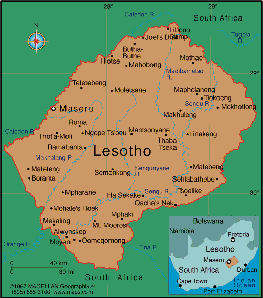
Map of Lesotho
Sovereign: King Letsie III (1996)
Prime Minister: Pakalitha Mosisili (2015)
Total area: 11,718 sq mi (30,350 sq km)
Population (2014 est.): 1,942,008
(growth rate: 0.34%); birth rate: 25.92/1000; infant mortality rate:
50.48/1000; life expectancy: 52.65
Capital and largest city (2011 est.):
Maseru 239,000
Monetary unit: Maluti
Languages:
English, Sesotho (both official); Zulu,
Xhosa
Ethnicity/race:
Sotho 99.7%, Europeans, Asians, and other
0.3%
Religions:
Christian 80%, indigenous beliefs 20%
National Holiday:
Independence Day, October 4
Literacy rate: 89.6% (2010 est.)
Economic summary: GDP/PPP (2013
est.): $4.265 billion; per capita $2,200. Real growth rate:
4.1%. Inflation: 5.0%. Unemployment: 25% (2008).
Arable land: 10.14%. Agriculture: corn, wheat, pulses,
sorghum, barley; livestock. Labor force: 874,200 (2013); 86%
of resident population engaged in subsistence agriculture; roughly
35% of the active male wage earners work in South Africa; industry
and services 14%. Industries: food, beverages, textiles,
apparel assembly, handicrafts, construction, tourism. Natural
resources: water, agricultural and grazing land, diamonds, sand,
clay, building stone. Exports: $941.2 million (2013
est.): manufactures 75% (clothing, footwear, road vehicles), wool
and mohair, food and live animals. Imports: $2.148
billion (2013 est.): food; building materials, vehicles,
machinery, medicines, petroleum products. Major trading
partners: U.S., Canada, UK, Hong Kong, China, India, South
Korea, Germany (2004).
Member of Commonwealth of Nations
Communications: Telephones: main lines
in use: 43,100 (2012); mobile cellular: 1.312 million (2011). Broadcast media:
1 state-owned TV station and 2 state-owned radio stations; government
controls most private broadcast media; satellite TV subscription service
available; transmissions of multiple international broadcasters
obtainable (2008). Internet Service Providers
(ISPs): 11,030 (2012). Internet users: 76,800 (2009).
Transportation: Railways: none. Highways: total: 5,940 km; paved: 1,069 km;
unpaved: 4,871 km (2011). Ports and harbors: none.
Airports: 24 (2013).
International disputes:
South Africa has placed military units to assist police operations
along the border of Lesotho, Zimbabwe, and Mozambique to control
smuggling, poaching, and illegal migration.
-------------------- o --------------------
No comments:
Post a Comment