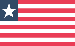
LIBERIA

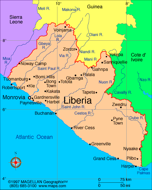
Geography: Lying on the Atlantic in the southern part of West Africa, Liberia is bordered by Sierra Leone, Guinea, and Côte d'Ivoire. It is comparable in size to Tennessee. Most of the country is a plateau covered by dense tropical forests, which thrive under an annual rainfall of about 160 in. a year.
Government: Republic.
History: Africa's first republic, Liberia was founded in 1822 as a result of the efforts of the American Colonization Society to settle freed American slaves in West Africa. The society contended that the emigration of blacks to Africa was an answer to the problem of slavery and the incompatibility of the races. Over the course of forty years, about 12,000 slaves were voluntarily relocated. Originally called Monrovia, the colony became the Free and Independent Republic of Liberia in 1847.
The English-speaking Americo-Liberians, descendants of former American slaves, make up only 5% of the population, but have historically dominated the intellectual and ruling class. Liberia's indigenous population is composed of 16 different ethnic groups.
The government of Africa's first republic was modeled after that of the United States, and Joseph Jenkins Roberts of Virginia was elected the first president. Ironically, Liberia's constitution denied indigenous Liberians equal to the lighter-skinned American immigrants and their descendants.
After 1920, considerable progress was made toward opening up the interior of the country, a process that facilitated by the 1951 establishment of a 43-mile (69-km) railroad to the Bomi Hills from Monrovia. In July 1971, while serving his sixth term as president, William V. S. Tubman died following surgery and was succeeded by his longtime associate, Vice President William R. Tolbert, Jr.

Map of Liberia
President: Ellen Johnson-Sirleaf
(2006)
Land area: 37,189 sq mi (96,320 sq km);
total area: 43,000 sq mi (111,370 sq km)
Population (2014 est.): 4,092,310
(growth rate: 2.52%); birth rate: 35.07/1000; infant mortality rate:
69.19/1000; life expectancy: 58.21
Capital and largest city (2011 est.):
Monrovia, 750,000
Monetary unit: Liberian dollar
Languages:
English 20% (official), some 20 ethnic group languages few of which can be written or used in correspondence
Ethnicity/race:
Kpelle 20.3%, Bassa 13.4%, Grebo 10%, Gio 8%, Mano 7.9%, Kru 6%, Lorma 5.1%, Kissi 4.8%, Gola 4.4%, other 20.1% (2008 Census)
Religions:
Christian 85.6%, Muslim 12.2%, Traditional 0.6%, other 0.2%, none 1.4% (2008 Census)
National Holiday:
Independence Day, July 26
Literacy rate: 60.8% (2010 est.)
Economic summary: GDP/PPP (2013
est.): $2.898 billion; per capita $700. Real growth rate:
8.1%. Inflation: 5.2%. Unemployment: 85% (2003 est.).
Arable land: 4.04%. Agriculture: rubber, coffee, cocoa,
rice, cassava (tapioca), palm oil, sugarcane, bananas; sheep, goats;
timber. Labor force: 1.372 million (2007): agriculture 70%, industry 8%, services
22% (2000 est.). Industries: rubber processing, palm oil
processing, timber, diamonds. Natural resources: iron ore,
timber, diamonds, gold, hydropower. Exports: $929.8 million
(2013 est.): rubber, timber, iron, diamonds, cocoa, coffee.
Imports: $2.457 billion (2013 est.): fuels, chemicals,
machinery, transportation equipment, manufactured goods; foodstuffs.
Major trading partners:
South Korea, Japan, China, Spain, Algeria, Thailand, Malaysia, France, Singapore (2012).
Communications: Telephones: main lines
in use: 3,200 (2011); mobile cellular: 2.394 million (2012). Broadcast media:
3 private TV stations; satellite TV service available; 1 state-owned
radio station; about 15 independent radio stations broadcasting in
Monrovia, with another 25 local stations operating in other areas;
transmissions of 2 international broadcasters are available (2007). Internet
Service Providers (ISPs): 7 (2012). Internet users: 20,000
(2009).
Transportation: Railways:
total: 429 km;
note: most sections of the railways were inoperable because of
damage suffered during the civil wars from 1980 to 2003, but many are
being rebuilt (2008). Highways:
total: 10,600 km; paved: 657 km; unpaved: 9,943 km (2000 est.).
Ports and harbors: Buchanan, Monrovia.
Airports: 28 (2013).
International disputes:
although civil unrest continues to abate with the assistance of 6,500
UN Mission in Liberia peacekeepers, as of January 2013, Liberian
refugees still remain in Guinea, Cote d'Ivoire, Sierra Leone, and Ghana;
Liberia, in turn, shelters refugees fleeing turmoil in Cote d'Ivoire;
despite the presence of over 9,000 UN forces in Cote d'Ivoire since
2004, ethnic conflict continues to spread into neighboring states who
can no longer send their migrant workers to Ivorian cocoa plantations;
UN sanctions ban Liberia from exporting diamonds and timber.
-------------------- o --------------------
No comments:
Post a Comment