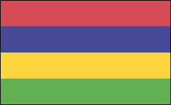
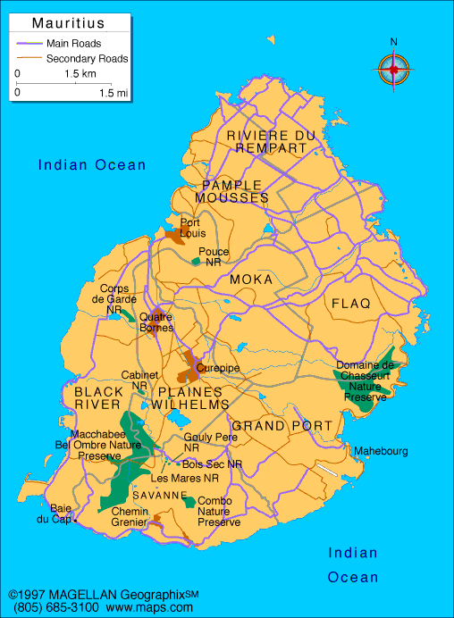
MAURITIUS

Geography: Mauritius is a mountainous island in the Indian Ocean east of Madagascar.
Government: Parliamentary democracy within the British Commonwealth.
History: After a brief Dutch settlement, French immigrants who came in 1715 named the island Île de France and established the first road and harbor infrastructure, as well as the sugar industry, under the leadership of Gov. Mahe de Labourdonnais. Blacks from Africa and Madagascar came as slaves to work in the sugarcane fields. In 1810, the British captured the island and in 1814, by the Treaty of Paris, it was ceded to Great Britain along with its dependencies.
Indian immigration, which followed the abolition of slavery in 1835, rapidly changed the fabric of Mauritian society, and the country flourished with the increased cultivation of sugarcane. The opening of the Suez Canal in 1869 heralded the decline of Mauritius as a port of call for ships rounding the southern tip of Africa, bound for South and East Asia. The economic instability of the price of sugar, the main crop, in the first half of the 20th century brought civil unrest, then economic, administrative, and political reforms. Mauritius became independent on March 12, 1968.

Map of
Mauritius
President:
Ameenah Gurib-Fakim (2015)
Prime
Minister: Anerood Jugnauth (2014)
Land area: 714 sq mi (1,849 sq km);
total area: 788 sq mi (2,040 sq km)
Population (2014 est.): 1,331,155 (growth
rate: 0.66%); birth rate: 13.46/1000; infant mortality rate: 10.59/1000;
life expectancy: 75.17
Capital and largest city (2011 est.):
Port Louis, 151,000
Monetary unit: Mauritian
rupee
Languages:
Creole 86.5%, Bhojpuri 5.3%, French 4.1%, two languages
1.4%, other 2.6% (includes English, the official language, which is
spoken by less than 1% of the population), unspecified 0.1% (2011 est.)
Ethnicity/race:
Indo-Mauritian 68%, Creole 27%, Sino-Mauritian
3%, Franco-Mauritian 2%
Religions:
Hindu 48.5%, Roman Catholic 26.3%, Muslim 17.3%, other Christian 6.4%, other 0.6%, none 0.7%, unspecified 0.1% (2011 est.)
National Holiday:
Independence Day, March 12
Literacy rate: 88.8% (2011 est.)
Economic summary: GDP/PPP (2013 est.):
$20.95 billion; per capita $ $16,100 . Real growth rate: 3.5%.
Inflation: 3.5%. Unemployment: 8.3%. Arable land:
38.24%. Agriculture: sugarcane, tea, corn, potatoes, bananas,
pulses; cattle, goats; fish. Labor force: 637,600; construction
and industry 30%, services 25%, agriculture and fishing 9%, trade,
restaurants, hotels 22%, transportation and communication 7%, finance
6% (2007). Industries: food processing (largely sugar milling),
textiles, clothing, chemicals, metal products, transport equipment,
nonelectrical machinery, tourism. Natural resources: arable
land, fish. Exports: $2.788 billion (2013 est.):
clothing and textiles, sugar, cut flowers, molasses. Imports:
$4.953 billion (2013 est.): manufactured goods, capital
equipment, foodstuffs, petroleum products, chemicals. Major trading
partners: UK, Spain, France, U.S., Madagascar, South Africa, Italy, China,
India (2012).
Member of Commonwealth of Nations
Communications: Telephones: main
lines in use: 349,100 (2012); mobile cellular: 1.485 million (2012).
Broadcast media: the government maintains
control over TV broadcasting through the Mauritius Broadcasting
Corporation (MBC), which operates 3 analog and 10 digital TV stations;
MBC is a shareholder in a local company that operates 2 pay-TV stations;
the state retains the largest radio broadcast network with multiple
stations; several private radio broadcasters have entered the market
since 2001; transmissions of at least 2 international broadcasters are
available (2007). Internet Service Providers (ISPs): 51,139 (2012).
Internet users: 290,000 (2009).
Transportation: Railways: 0 km.
Highways: total: 2,149 km; paved: 2,149 km (including 75 km of
expressways) (2012). Ports and harbors: Port Louis.
Airports: 5 (2013).
International
disputes: Mauritius and Seychelles claim the Chagos Islands; claims French-administered Tromelin Island.
-------------------- o --------------------
No comments:
Post a Comment