MONGOLIA
Geography: Mongolia lies in central Asia between Siberia on the north and China on the south. It is slightly larger than Alaska.
The productive regions of Mongolia—a tableland ranging from 3,000 to 5,000 ft (914 to 1,524 m) in elevation—are in the north, which is well drained by numerous rivers, including the Hovd, Onon, Selenga, and Tula. Much of the Gobi Desert falls within Mongolia.
Government: Parliamentary republic now in transition from communism.
History: Nomadic tribes that periodically plundered agriculturally based China from the west are recorded in Chinese history dating back more than 2,000 years. It was to protect China from these marauding peoples that the Great Wall was constructed around 200 B.C. The name Mongol comes from a small tribe whose leader, Ghengis Khan, began a conquest that would eventually encompass an enormous empire stretching from Asia to Europe, as far west as the Black Sea and as far south as India and the Himalayas. But by the 14th century, the kingdom was in serious decline, with invasions from a resurgent China and internecine warfare.
The State of Mongolia was formerly known as Outer Mongolia. It contains the original homeland of the historic Mongols, whose power reached its zenith during the 13th century under Kublai Khan. The area accepted Manchu rule in 1689, but after the Chinese Revolution of 1911 and the fall of the Manchus in 1912, the northern Mongol princes expelled the Chinese officials and declared independence under the Khutukhtu, or “Living Buddha.”
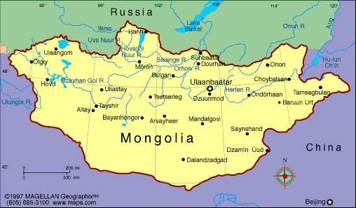
Map of Mongolia
President: Tsakhiagiyn Elbegdorj
(2009)
Prime Minister: Chimediin Saikhanbileg
(2014)
Total area: 604,247 sq mi (1,565,000 sq
km)
Population (2014 est.): 2,953,190
(growth rate: 1.37%); birth rate: 20.88/1000; infant mortality rate:
23.15/1000; life expectancy: 68.98
Capital and largest city (2011 est.):
Ulaan Baatar, 1.184 million
Monetary unit: Tugrik
National name: Mongol Uls
Languages:
Mongolian, 90%; also Turkic and Russian
(1999)
Ethnicity/race:
Khalkh 81.9%, Kazak 3.8%, Dorvod 2.7%, Bayad 2.1%,
Buryat-Bouriates 1.7%, Zakhchin 1.2%, Dariganga 1%, Uriankhai 1%, other
4.6% (2010 est.)
Religions:
Buddhist 53%, Muslim 3%, Christian 2.2%, Shamanist 2.9%, other 0.4%, none 38.6% (2010 est.)
National Holiday:
Independence Day/Revolution Day, July 11
Literacy rate: 97.4% (2011 est.)
Economic summary: GDP/PPP (2013
est.): $17.03 billion; per capita $5,900. Real growth rate:
11.8%. Inflation: 8.2%. Unemployment: 9%. Arable land: 0.39%. Agriculture: wheat, barley, vegetables, forage crops;
sheep, goats, cattle, camels, horses. Labor force: 1.037
million; agriculture 33%, industry 10.6%, services 56.4%, (2011).
Industries: construction and construction materials; mining
(coal, copper, molybdenum, fluorspar, tin, tungsten, and gold); oil;
food and beverages; processing of animal products, cashmere and
natural fiber manufacturing. Natural resources: oil, coal,
copper, molybdenum, tungsten, phosphates, tin, nickel, zinc,
wolfram, fluorspar, gold, silver, iron, phosphate. Exports:
$4.294 billion (2013 est.): copper, apparel, livestock,
animal products, cashmere, wool, hides, fluorspar, other nonferrous
metals. Imports: $5.696 (2013 est.): machinery and
equipment, fuel, cars, food products, industrial consumer goods,
chemicals, building materials, sugar, tea. Major trading
partners: China, Canada, U.S., Russia, South Korea, Japan (2012).
Communications: Telephones: main lines
in use: 176,700 (2012); mobile cellular: 3.375 million (2012). Broadcast media: following
a law passed in 2005, Mongolia's state-run radio and TV provider
converted to a public service provider; also available are private radio
and TV broadcasters, as well as multi-channel satellite and cable TV
providers; more than 100 radio stations, including some 20 via repeaters
for the public broadcaster; transmissions of multiple international
broadcasters are available (2008). Internet Service Providers (ISPs): 20,084
(2012). Internet users: 330,000 (2008).
Transportation: Railways: total: 1,908
km (2010). Roadways: total: 49,249 km; paved: 4,800 km;
unpaved: 44,449 km (2013). Ports and harbors:
580 km (the only waterway in operation is Lake Hovsgol) (135 km);
Selenge River (270 km) and Orhon River (175 km) are navigable but carry
little traffic; lakes and rivers freeze in winter, they are open from
May to September) (2010).
Airports: 44 (2013).
International disputes: none.
-------------------- o --------------------
No comments:
Post a Comment