SURINAME
Geography: Suriname lies on the northeast coast of South America, with Guyana to the west, French Guiana to the east, and Brazil to the south. It is about one-tenth larger than Michigan. The principal rivers are the Corantijn on the Guyana border, the Marowijne in the east, and the Suriname, on which the capital city of Paramaribo is situated.
Government: Constitutional democracy.
History: Suriname's earliest inhabitants were the Surinen Indians, after whom the country is named. By the 16th century they had been supplanted by other South American Indians. Spain explored Suriname in 1593, but by 1602 the Dutch began to settle the land, followed by the English. The English transferred sovereignty to the Dutch in 1667 (the Treaty of Breda) in exchange for New Amsterdam (New York). Colonization was confined to a narrow coastal strip, and until the abolition of slavery in 1863, African slaves furnished the labor for the coffee and sugarcane plantations. Escaped African slaves fled into the interior, reconstituted their western African culture, and came to be called “Bush Negroes” by the Dutch. After 1870, East Indian laborers were imported from British India and Javanese from the Dutch East Indies.
Known as Dutch Guiana, the colony was integrated into the kingdom of the Netherlands in 1948. Two years later Dutch Guiana was granted home rule, except for foreign affairs and defense. After race rioting over unemployment and inflation, the Netherlands granted Suriname complete independence on Nov. 25, 1975. A coup d'état in 1980 brought military rule. During much of the 1980s, Suriname was under the repressive control of Lieut. Col. Dési Bouterse. The Netherlands stopped all aid in 1982 when Suriname soldiers killed 15 journalists, politicians, lawyers, and union officials. Defense spending increased significantly, and the economy suffered. A guerrilla insurgency by the Jungle Commando (a Bush Negro guerrilla group) threatened to destabilize the country and was harshly suppressed by Bouterse. Free elections were held on May 25, 1991, depriving the military of much of its political power. In 1992 a peace treaty was signed between the government and several guerrilla groups. In March 1997, the president announced new economic measures, including eliminating import tariffs on most basic goods, coupled with strict price controls. Later that year, the Netherlands said it would prosecute Bouterse for cocaine trafficking.
Public discontent over the 70% inflation rate prompted President Jules Wijdenbosch to hold elections in May 2000, a year ahead of schedule. The New Front for Democracy and Development, a coalition led by former president Ronald Venetiaan, won the election. Venetiaan was reelected in Aug. 2005.
In May 2006, torrential flooding left more than 20,000 homeless.
In July 2007, a United Nations tribunal settled a long-simmering maritime dispute between Suriname and Guyana. The UN redrew the maritime border to give both countries access to an area potentially rich in oil deposits.
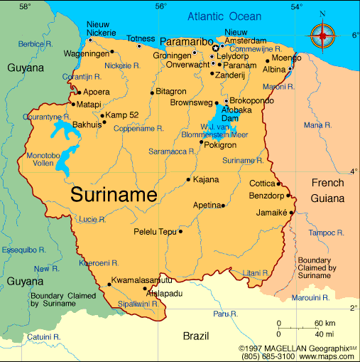
Map of Suriname
President:
Dési Bouterse (2010)
Vice President: Robert Ameerali (2010)
Land area: 62,344 sq mi (161,471 sq km);
total area: 63,039 sq mi (163,270 sq km)
Population (2014 est.): 573,311 (growth
rate: 1.12%); birth rate: 16.73/1000; infant mortality rate: 27.07/1000;
life expectancy: 71.69; density per sq mi: 7.6
Capital and largest city (2011 est.):
Paramaribo, 278,000
Monetary unit: Surinamese dollar
National
name: Republiek Suriname
Languages:
Dutch (official), English (widely spoken), Sranang Tongo
(Surinamese, sometimes called Taki-Taki, is native language of Creoles
and much of the younger population and is lingua franca among others),
Caribbean Hindustani (a dialect of Hindi), Javanese
Ethnicity/race:
East Indians (Hindustanis) 37%, Creole (mixed
white and black) 31%, Javanese 15%, “Bush Negroes” (also known as
Maroons) 10%, Amerindian 2%, Chinese 2%, white 1%, other 2%
Religions:
Hindu 27.4%, Protestant 25.2% (predominantly
Moravian), Roman Catholic 22.8%, Islam 19.6%, indigenous 5%
Literacy rate: 94.7% (2010 est.)
Economic summary: GDP/PPP (2013 est.):
$7.12 billion; per capita $12,900. Real growth rate: 4.7%.
Inflation: 4.2%. Unemployment: 9% (2008). Arable
land: 0.36%. Agriculture: rice, bananas, palm kernels,
coconuts, plantains, peanuts; beef, chickens; shrimp; forest products.
Labor force: 165,600 (2007); agriculture 8%, industry 14%,
services 78%. Industries: bauxite and gold mining, alumina
production; oil, lumbering, food processing, fishing. Natural
resources: timber, hydropower, fish, kaolin, shrimp, bauxite,
gold, and small amounts of nickel, copper, platinum, iron ore.
Exports: $2.512 billion (2013 est.): alumina, gold, crude oil,
lumber, shrimp and fish, rice, bananas. Imports: $1.778 billion
(2013 est.): capital equipment, petroleum, foodstuffs, cotton,
consumer goods. Major trading partners: Norway, U.S., Canada,
Belgium, France, UAE, Netherlands, Japan, China, Guyana, Antilles, Antigua and Barbuda,
Brazil (2012).
Communications:
Telephones: main lines in use: 83,000 (2012); mobile cellular:
977,000 (2012). Radio broadcast stations: AM 4, FM 13, shortwave
1 (2007). Radios: 300,000 (1997). Television broadcast
stations: 2 (plus seven repeaters) (2007). Televisions:
63,000 (1997). Internet Service Providers (ISPs): 188 (2012).
Internet users: 163,000 (2009).
Transportation: Railways: total: 166 km
(single track) (2001). Highways: total: 4,304 km; paved: 1,130
km; unpaved: 3,174 km (2003). Waterways: 1,200 km; most
important means of transport; oceangoing vessels with drafts ranging
up to 7 m can navigate many of the principal waterways (2011). Ports and
harbors: Paramaribo, Wageningen. Airports: 55 (2013).
International disputes:
area claimed by French Guiana between Riviere Litani and Riviere
Marouini (both headwaters of the Lawa); Suriname claims a triangle of
land between the New and Kutari/Koetari rivers in a historic dispute
over the headwaters of the Courantyne; Guyana seeks United Nations
Convention on the Law of the Sea arbitration to resolve the longstanding
dispute with Suriname over the axis of the territorial sea boundary in
potentially oil-rich waters.
-------------------- o --------------------
No comments:
Post a Comment