SWAZILAND
Geography: Swaziland, which is about 85% the size of New Jersey, is surrounded by South Africa and Mozambique. The country is largely mountainous.
Government: Absolute monarchy.
History: Bantu peoples migrated southwest to the area of Mozambique in the 16th century. A number of clans broke away from the main body in the 18th century and settled in Swaziland. In the 19th century these clans organized as a tribe, partly because they were in constant conflict with the Zulu. Their ruler, Mswazi, appealed to the British in the 1840s for help against the Zulu. The British and the Transvaal governments guaranteed the independence of Swaziland in 1881.
South Africa held Swaziland as a protectorate from 1894 to 1899, but after the Boer War, in 1902, Swaziland was transferred to British administration. The paramount chief was recognized as the native authority in 1941. In 1963, the territory was constituted a protectorate, and on Sept. 6, 1968, it became the independent nation of Swaziland.
Since 1986, King Mswati III has ruled as sub-Saharan Africa's last absolute monarch. Political parties are banned and the king appoints 10 of the 65 members of parliament as well as the prime minister. King Mswati can veto any law passed by the legislature and frequently rules by decree.
In 2002, hundreds of thousands of Swazis faced starvation. Two years of drought as well as bad planning and poor agricultural practices were blamed for the crisis. The government came under criticism for buying the king a $50-million luxury jet—a quarter of the national budget—while famine loomed. In 2002, the country's judges resigned en masse in protest of the government's refusal to comply with court decisions. In April 2003, the government information minister announced that the media were banned from making negative remarks about the government—criticism of the king's new luxury jet in particular would not be tolerated. In 2004, a third year of drought befell the country. International donor agencies and human rights groups condemned the king's plans to build new multimillion-dollar palaces for each of his 11 wives (12 by 2005) while his people faced starvation and the country's AIDS epidemic spiraled out of control. About 30% of the population is infected.
Although the king signed the country's first constitution in Aug. 2005, the document essentially maintains the status quo: opposition parties remain banned and the king retains ultimate power.
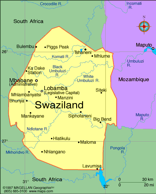
Map of
Swaziland
Kingdom of Swaziland
Ruler: King Mswati III (1986)
Prime Minister: Barnabas Sibusiso
Dlamini (1996)
Land area: 6,641 sq mi (17,200 sq km);
total area: 6,704 sq mi (17,363 sq km)
Population (2014 est.): 1,419,623
(growth rate: 1.14%); birth rate: 25.18/1000; infant mortality rate:
54.82/1000; life expectancy: 50.54; density per sq mi: 176.8
Capital (2011 est.):
Mbabane, 66,000; Royal and legislative
capital: Lobamba, 11,000
Largest city: Mbabane, 66,000
Monetary unit: Lilangeni
Languages:
English, siSwati (both official)
Ethnicity/race:
African 97%, European 3%
Religions:
Zionist (a blend of Christianity and
indigenous ancestral worship) 40%; Roman Catholic 20%; Muslim 10%;
Anglican, Bahai, Methodist, Mormon, Jewish, and other 30%
Literacy rate: 87.8% (2011 est.)
Economic summary: GDP/PPP (2013
est.): $6.259 billion; per capita $5,700. Real growth rate:
0%. Inflation: 6.1%. Unemployment: 40% (2006). Arable
land: 10.08%. Agriculture: sugarcane, cotton, corn, tobacco,
rice, citrus, pineapples, sorghum, peanuts; cattle, goats, sheep.
Labor force: 424,100 (2011). Industries: coal, wood pulp, sugar, soft drink concentrates, textiles and apparel. Natural resources: asbestos, coal, clay,
cassiterite, hydropower, forests, small gold and diamond deposits,
quarry stone, talc. Exports: $1.603 billion (2013
est.): soft drink concentrates, sugar, wood pulp, cotton yarn,
refrigerators, citrus and canned fruit. Imports: $1.545
billion (2013 est.): motor vehicles, machinery, transport
equipment, foodstuffs, petroleum products, chemicals. Major
trading partners: South Africa, EU, U.S., Mozambique, Japan,
Singapore (2004).
Member of Commonwealth of Nations
Communications: Telephones: main lines
in use: 48,600 (2012); mobile cellular: 805,000 (2012). Radio
broadcast stations: AM 3, FM 2 plus 4 repeaters, shortwave 3
(2001). Radios: 170,000 (1999). Television broadcast
stations: 3 plus relay stations (2007). Televisions:
23,000 (2000). Internet Service Providers (ISPs): 2,744 (2012).
Internet users: 90,100 (2009).
Transportation: Railways: total: 301 km
(2008). Highways: total: 3,594 km (2002). Ports and
harbors: none. Airports: 14 (2013).
International disputes: In 2006, King Mswati III advocated resorting to ICJ to claim parts of Mpumalanga and KwaZulu-Natal from South Africa.
-------------------- o --------------------
No comments:
Post a Comment