TONGA

Geography: Situated east of the Fiji Islands in the South Pacific, Tonga (also called the Friendly Islands) consists of some 150 islands, of which 36 are inhabited. Most of the islands contain active volcanic craters; others are coral atolls.
Government: Hereditary constitutional monarchy.
History: Polynesians have lived on Tonga for at least 3,000 years. The Dutch were the first to explore the islands, landing on Tafahi in 1616. British explorer James Cook landed on islands in 1773 and 1777 and dubbed them the Friendly Islands. The current royal dynasty of Tonga was founded in 1831 by Taufa'ahau Tupou, who took the name George I. He consolidated the kingdom by conquest and in 1875 granted a constitution. In 1900, his great-grandson, George II, signed a treaty of friendship with Britain, and the country became a British protected state. The treaty was revised in 1959. Tonga became independent on June 4, 1970.
The government is largely controlled by the king, his nominees, and a small group of hereditary nobles. In the 1990s a movement began aimed at curtailing the powers of the monarchy, and the Tongan Pro-Democracy Movement (TPDM) has continued to gain in popular support. In 1999, Tonga gained UN membership.
The king's official court jester, American Jesse Bogdonoff, a former salesman of magnets to relieve back pain, was sued by the government in 2002 for squandering $26 million of Tonga's money (40% of its annual revenue) in unsound investment schemes. In 2004, he agreed to pay a $1 million settlement.
The king grew increasingly authoritarian and has curtailed press freedom. In 2005, 3,000 civil servants went on strike, demanding better pay. Throughout 2005, discontent with economic and social inequities intensified throughout the kingdom. As a result, Prince 'Ulukalala Lavaka Ata resigned as prime minister in Feb. 2006. The following month pro-democracy leader Feleti Sevele became the first elected commoner to serve as the country's prime minister. In Aug. 2006, the king died and was replaced by his son, George Tupou V.
In a 14–12 vote, Tu'ivakano was elected prime minister over 'Akilisi Pohiva and was sworn in on Dec. 22, 2010.
On March 18, 2012, King George Tupou V died. After his death, his younger brother, ʻAhoʻeitu ʻUnuakiʻotonga Tukuʻaho Tupou VI, became King of Tonga as Tupou VI.
On Dec. 30, 2014, ʻAkilisi Pohiva succeeded Tu'ivakano as prime minister. The leader of the Democratic Party of the Friendly Islands, Pohiva became the first commoner to be elected prime minister. He won with a vote of 15 over Samiu Vaipulu who received 11 votes.
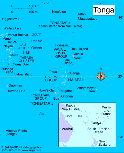
Map of Tonga
Sovereign: Tupou VI (2012)
Prime Minister: ʻAkilisi Pohiva (2014)
Land area: 277 sq mi (717 sq km); total
area: 289 sq mi (748 sq km)
Population (2014 est.): 106,440 (growth
rate: 0.09%); birth rate: 23.55/1000; infant mortality rate:
12.36/1000; life expectancy: 75.82; density per sq mi: 360
Capital and largest city (2011 est.):
Nuku'alofa, 25,000
Monetary unit: Pa'anga
Kingdom of Tonga
Languages:
English and Tongan 87%, Tongan (official) 10.7%, English (official) 1.2%, other 1.1%, uspecified 0.03%
Ethnicity/race:
Tongan 96.6%, part-Tongan 1.7%, other 1.7%, unspecified 0.03%
Religion:
Protestant 64.9% (includes Free Wesleyan Church 37.3%,
Free Church of Tonga 11.4%, Church of Tonga 7.2%, Tokaikolo Christian
Church 2.6%, Assembly of God 2.3% Seventh Day Adventist 2.2%,
Constitutional Church of Tonga .9%, Anglican .8% and Full Gospel Church
.2%), Mormon 16.8%, Roman Catholic 15.6%, other 1.1%, none 0.03%,
unspecified 1.7%
Literacy rate: 99% (2006 est.)
Economic summary: GDP/PPP (2013
est.): $846 million; per capita $8,200. Real growth rate:
1%. Inflation: 2%. Unemployment: 13% (FY03/04
est.). Arable land: 21.33%. Agriculture: squash,
coconuts, copra, bananas, vanilla beans, cocoa, coffee, ginger,
black pepper; fish. Labor force: 39,960 (2007); agriculture
31.8%, industry and services 30.6% (2003 est.). Industries:
tourism, construction, fishing. Natural resources: fish, fertile soil.
Exports: $9.1 million (2013 est.): squash, fish,
vanilla beans, root crops. Imports: $122.5 million (2013
est.): foodstuffs, machinery and transport equipment, fuels,
chemicals. Major trading partners: Japan, China, U.S.,
Taiwan, New Zealand, Fiji, Australia, American Samoa, Samoa, South Korea, Hong Kong, Brazil (2011).
Member of Commonwealth of Nations
Communications: Telephones: main lines
in use: 30,000 (2012); mobile cellular: 56,000 (2012). Radio
broadcast stations: 2 state-owned TV stations and 2
privately-owned TV stations; satellite and cable TV services are
available; 2 state-owned and 3 privately-owned radio stations; Radio
Australia broadcasts available satellite (2009).
Radios: 61,000 (1997). Television broadcast stations:
2 (2001). Televisions: 2,000 (1997). Internet Service
Providers (ISPs): 5,367 (2012). Internet users: 8,400
(2009).
Transportation: Railways: 0 km.
Highways: total: 680 km; paved: 184 km; unpaved: 496 km (2011
est.). Ports and harbors: Neiafu, Nuku'alofa, Pangai.
Airports: 6 (2013).
International disputes: none.
-------------------- o --------------------
No comments:
Post a Comment