TURKMENISTAN
Geography: Turkmenistan (formerly Turkmenia) is bounded by the Caspian Sea in the west, Kazakhstan in the north, Uzbekistan in the east, and Iran and Afghanistan in the south. About nine-tenths of Turkmenistan is desert, chiefly the Kara-Kum. One of the world's largest sand deserts, it is approximately 138,966 sq mi (360,000 sq km).
Government: One-party republic.
History: Turkmenistan was once part of the ancient Persian Empire. The Turkmen people were originally pastoral nomads and some of them continued this way of life up into the 20th century, living in transportable dome-shaped felt tents. The territory was ruled by the Seljuk Turks in the 11th century. The Mongols of Ghenghis Khan conquered the land in the 13th century; they dominated the area for the next two centuries until they were deposed in the late 15th century by invading Uzbeks. Prior to the 19th century, Turkmenia was divided into two lands, one belonging to the khanate of Khiva and the other belonging to the khanate of Bukhara. In 1868, the khanate of Khiva was made part of the Russian Empire and Turkmenia became known as the Transcaspia Region of Russian Turkistan. Turkmenistan was later formed out of the Turkistan Autonomous Soviet Socialist Republic, founded in 1922, and was made an independent Soviet Socialist Republic on May 13, 1925. It was the poorest of the Soviet republics.
Turkmenistan declared its sovereignty in Aug. 1990 and became a member of the Commonwealth of Independent States on Dec. 21, 1991, together with ten other former Soviet republics. It established a government more authoritarian than those functioning in the other newly independent central Asian republics. President Saparmurat Niyazov, also called the Turkmenbashi (Leader of All Turkmens), has attempted to create a cult of personality through extravagant self-promotion. Cities, aftershave, and a meteor now bear his name. In 2002, he renamed all the months of the calendar—April is now named after his mother. Niyazov was voted president-for-life by his rubber-stamp parliament in 1999.
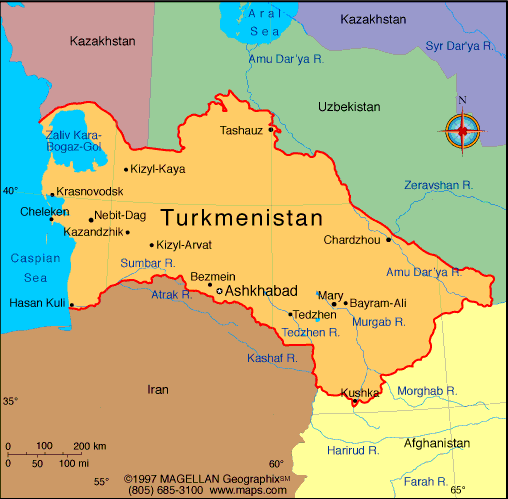
Map of
Turkmenistan
President: Gurbanguly Berdymukhammedov
(2007)
Total area: 188,455 sq mi (488,100 sq km)
Population (2014 est.): 5,171,943
(growth rate: 1.14%); birth rate: 19.46/1000; infant mortality rate:
38.13/1000; life expectancy: 69.47; density per sq mi: 27.1
Capital and largest city (2012 est.):
Ashgabat, 727,700
Other large cities: Turkmenabat,
234,817; Dasoguz 166,500
Monetary unit: Manat
Languages:
Turkmen (official) 72%; Russian 12%; Uzbek 9%, other
7%
Ethnicity/race:
Turkmen 85%, Uzbek 5%, Russian 4%, other 6%
(2003)
Religions:
Islam 89%, Eastern Orthodox 9%, unknown 2%
Literacy rate: 99.6% (2011 est.)
Economic summary: GDP/PPP (2013
est.): $55.16 billion; per capita $9,700. Real growth rate:
12.2% (2013 est.). Inflation: 9%. Unemployment:
60% (2004 est.). Arable land: 3.89%. Agriculture:
cotton, grain, melons; livestock. Labor force: 2.3 million (2008
est.); agriculture 48.2%, industry 14%, services 37.8% (2004 est.).
Industries: natural gas, oil, petroleum products, textiles,
food processing. Natural resources: petroleum, natural gas,
sulfur, salt. Exports: $17.13 billion (2013 est.):
gas, crude oil, petrochemicals, cotton fiber, textiles.
Imports: $12.48 billion (2013 est.): machinery and
equipment, chemicals, foodstuffs. Major trading partners:
China, Turkey, Italy, Russia, UAE, UK, Ukraine, Germany (2012).
Communications: Telephones: main lines
in use: 575,000 (2012); mobile cellular: 3.953 million (2012). Radio
broadcast stations: broadcast media is government
controlled and censored; 7 state-owned TV and 4 state-owned radio
networks; satellite dishes and programming provide an alternative to the
state-run media; officials sometimes limit access to satellite TV by
removing satellite dishes (2007).
Radios: 1.225 million (1997). Television broadcast
stations: 3 (much programming relayed from Russia and Turkey)
(1997). Televisions: 820,000 (1997). Internet Service
Providers (ISPs): 714 (2012) Internet users: 80,400 (2009).
Transportation: Railways: total: 2,980
km (2008). Highways: total: 58,592 km; paved: 47,577 km;
unpaved: 11,015 km (2002 est.). Waterways: 1,300 km (Amu Darya and Kara Kum canal are important inland waterways) (2011). Ports and harbors: Turkmenbasy
Airports: 26 (2013).
International disputes: Cotton
monoculture in Uzbekistan and Turkmenistan creates water-sharing
difficulties for Amu Darya river states; field demarcation of the
boundaries with Kazakhstan commenced in 2005, but Caspian seabed
delimitation remains stalled with Azerbaijan, Iran, and Kazakhstan due
to Turkmenistan's indecision over how to allocate the sea's waters and
seabed; bilateral talks continue with Azerbaijan on dividing the seabed
and contested oilfields in the middle of the Caspian.
-------------------- o --------------------
No comments:
Post a Comment